Stonehenge
This is the postcard .....

... and this is the reality, raining in max.


... and this is the reality, raining in max.


Stonehenge
is a massive stone monument located
on
a chalky plain north of the modern-day city of
Salisbury,
England. Research shows that the site
has
continuously evolved over a period of about
10,000
years. The structure that we call “Stonehenge”
was
built between roughly 5,000 and 4,000 years ago
and
that forms just one part of larger, and
highly complex, sacred landscape. The
biggest
of
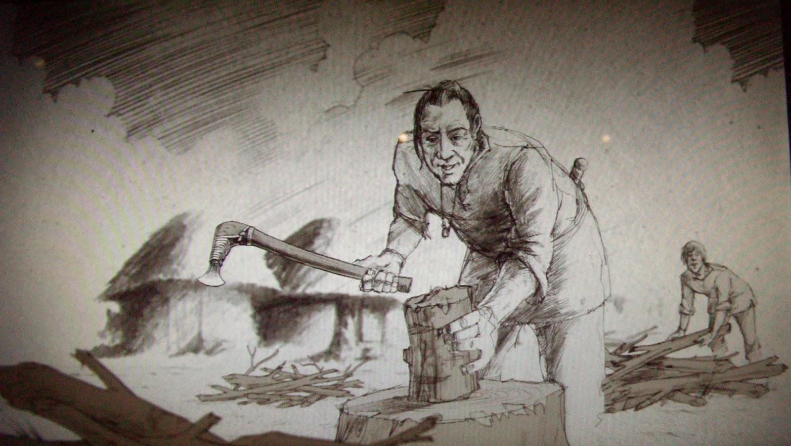
Stonehenge’s stones, known as sarsens,
are
up to 30 feet (9 meters) tall and
weigh
25 tons (22.6 metric tons) on average.
It
is widely believed that they were brought
from
Marlborough Downs, a distance of
20
miles (32 kilometers) to the north.
Smaller
stones, referred to as “bluestones”
(they
have a bluish tinge when wet or freshly broken),
weigh
up to 4 tons and come from
several different
sites
in western Wales, having been
transported
as far as 140 miles (225 km).
It’s
unknown how people in antiquity moved
them
that far. Scientists have raised the possibility
that
during the last ice age glaciers carried
these bluestones closer
to the Stonehenge area
and
the monument’s makers didn't have
to
move them all the way from Wales.
Water
transport through raft is another idea
that
has been proposed but researchers now
question whether
this method was viable.

Salisbury
Plain was considered to be a sacred area
long
before Stonehenge itself was constructed.
As
early as 10,500 years ago, three large pine posts,
which were totem poles of
sorts, were erected at the site.
Hunting
played an important role in the area.
Recently researchers
uncovered roughly 350 animal
bones
and 12,500 flint tools or fragments, just a mile away
from
Stonehenge, the finds dating from 7500 B.C.
to
4700 B.C. The presence of abundant game may
have
led people to consider the area sacred.
Recently
researchers have also discovered a massive
wooden
building, which may have been used for
burial
rituals. Also, dozens of burial mounds have
been discovered near Stonehenge
indicating that
hundreds, if not thousands, of
people were buried there
in ancient times. At least 17
shrines, some in the
shape of a circle, have also
been discovered near Stonehenge.
As
time went on the landscape continued to change.
Around
5,500 years ago, two earthworks known as
Cursus
monuments were erected, the longest
of
which ran for 1.8 miles (3 km).
More
construction occurred around 5,000 years ago
with
postholes indicating that either bluestones or
upright
timber posts were propped up on the site.
Then,
around 4,600 years ago, a double circle made
using
dozens of bluestones was created at the site.
By
4,400 years ago, Stonehenge had changed again,
having a series of sarsen
stones erected in the
shape of a horseshoe, with
every pair of these huge
stones having a stone
lintel connecting them.
In turn, a ring of
sarsens surrounded this
horseshoe, their
tops connecting to each other,
giving the appearance of a
giant interconnected
stone circle surrounding
the horseshoe.
By
4,300 years ago, Stonehenge had been expanded to
include
the addition of two bluestone rings,
one
inside the horseshoe and another between
the horseshoe and the outer
layer of interconnected
sarsen stones.Construction at
Stonehenge slowed
down
around 4,000 years ago. As time went on
the
monument fell into neglect and disuse, some of its
stones
fell over while others were taken away.
Suddenly,
you've got a link between
[the
long Cursus pit] and Stonehenge through two massive
pits,
which
appear to be aligned on the sunrise and
sunset
on the mid-summer solstice," said University
of
Birmingham archaeologist Vincent Gaffney,
who
is leading the project to map Stonehenge and
its
environs. Recently, archaeologists found an
interesting
connection between the earlier Cursus
monuments
and the later Stonehenge. They found
that
the longest Cursus monument had two pits, one on the
east and
one on the west. These pits, in turn, align with
Stonehenge’s
heel stone and a processional avenue.
3000 BC

2500 BC


2200 BC


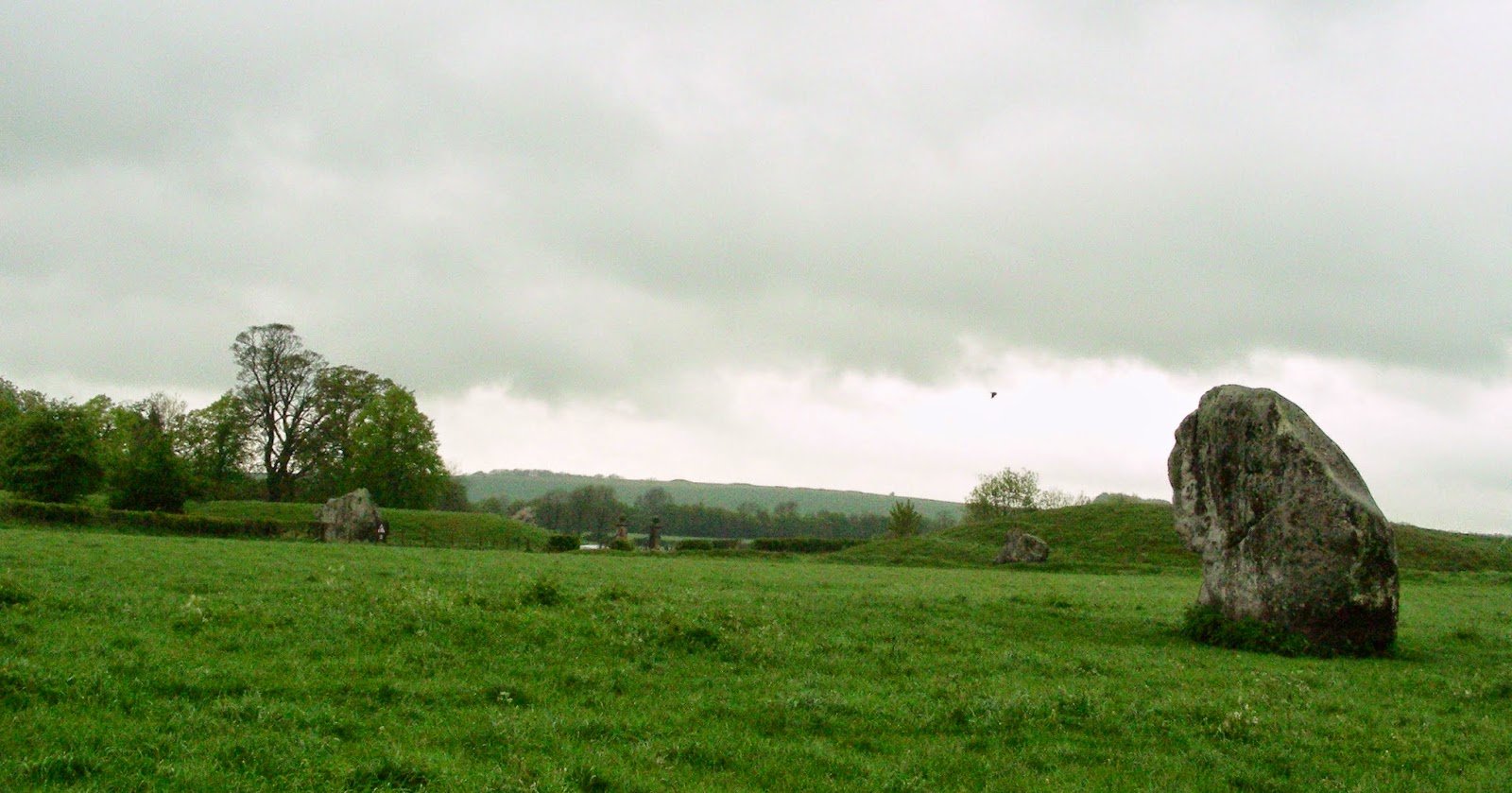
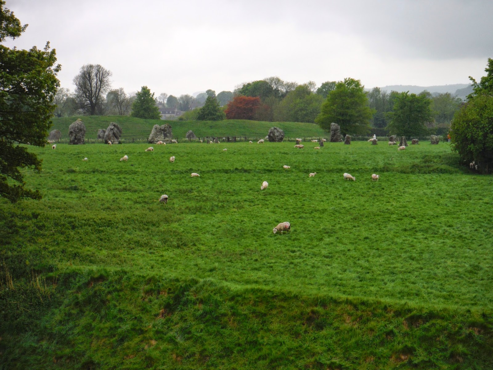
Avebury

Silbury Hill


Of all the historical landmarks spread throughout the British Isles
Silbury Hill is one of the most remarkable. Accepted as the largest
man-made mound in pre-industrial Europe it has a symmetry that
makes it seem almost modern....on seeing it for the first-time the
uninformed visitor can get quite a surprise on learning of its antiquity.
At 130 feet high and covering an area in excess of 5 acres the
enormous contours of the hill still challenge us with the mystery of
why it was built and what for, but the solution to the mystery of
how it has survived for 4,500 years without eroding away has
been known from some early excavations.
As the diagram shows, the uppermost part was built as a series
of drums each getting progressively smaller in diameter with
increasing height. Each drum is about 17 feet in height with
the outer wall leaning in at an angle for added stability. The
inside of each drum consists of a series of radial walls similar
to a spider's web which divide the drums into
compartments each of which are filled with chalk the walls
themselves having been built with chalk blocks.
A recent survey of the hill now indicates that the drums
are more in the form of polyhedra than circular
and may have been built in such a way as to allow the "steps"
to form a spiral trackway leading to its summit. The construction
of Silbury demonstrates a high level of sophistication. This
produces a further mystery...... How did the knowledge of
building in this way arrive at Avebury?
Surrounding the base of the hill is an extensive ditch which is
elongated on the western flank. It is believed that it may have
been deliberately filled with water when Silbury was first constructed.
number of tunnels have been dug into the hill commencing
in 1776 when the Duke of Northumberland employed Cornish
tin miners to sink a shaft from the top of the hill. This particular
shaft seems to have contributed to a disaster for the hill when on
May 29th. 2000 a large hole nearly 20m deep appeared on the
summit. Although the various tunnels and excavations over
the years have failed to produce any solution as to the purpose
of Silbury they have revealed that the hill was built in three
stages starting with a primary mound about 16 feet high and
120 feet in diameter. Accurate dating for the construction has
proved difficult to achieve but carbon dating of some
antler-pick remains recently found at the summit of the
hill indicate that its construction was completed about 2500 BC
which pre-dates the building of the avenues
by about a century. The year of its birth may never be known
with any certainty but evidence obtained from remnants of insects
which were found in the hill's base layer indicate that the building
of Silbury probably commenced during the month of August*.
There is evidence that a substantial Roman building once existed
adjacent to the base of the hill on its southern side and recent
surveys have now revealed that an extensive Roman settlement
surrounded the road adjacent to the hill. Quite what the
Romans thought about Silbury poses an interesting question......
they certainly used it as a marker when constructing the
adjacent A4 road though it is hard to imagine that it didn't play
a more substantial role in their lives at some time.
During 2007 a massive project to stabilise the hill has been undertaken.
This is a result of the damage caused by the various tunnels that
have left substantial voids over the years. The work has allowed
archaeologists access to the hill's interior and much fresh information
has been obtained as a result. Hopefully a more precise understanding
of the construction and chronology will be the outcome*. A very
interesting development has been the discovery of sarsens within
the hill which suggests that it conceals a megalithic structure of
some sort. It is considered that the remains of a stone
circle might be one possibility.
Whatever motivated its builders Silbury hill remains one of the
most astonishing achievements of that period. The amount
of labour it required reveals that the population of the Avebury
region at that time was large and able to form a cohesive
work-force. If the purpose of Silbury could be understood
perhaps the meaning of Avebury as a whole would be much clearer.


West Kennett Long Barrow


The West
Kennett Long Barrow is a Neolithic tomb or barrow.
The
site was recorded by John Aubrey in the 17th century
and
by William Stukeley in the 18th
century.
Archeologists classify it as a chambered long
barrow
and
one
of the Severn-Cotswold tombs. It has two pairs
of opposing transept chambers and a
single terminal
chamber used for burial. The stone burial
chambers
are located at one end of one of the
longest barrows
in Britain at 100 m: in total it is
estimated that 15,700
man-hours were expended in its
construction. The entrance
consists of
a concave forecourt with a facade made from
large
slabs of sarsen stones which were placed to seal entry.
The
construction of the West Kennett Long Barrow
commenced about
3600 BC, which is some 400 years
before the first stage
of Stonehenge,
and it was in use
until around 2500 BC. The mound has been
damaged
by indiscriminate digging, but archaeological
excavations in
1859 and 1955-56 found at least 46 burials,
ranging from
babies to elderly persons. The bones were
disarticulated
with some of the skulls and long bones
missing. It has been
suggested that the bones were removed
periodically for
display or transported elsewhere with the
blocking facade being
removed and replaced each time.
Recent re-analysis of the
dating evidence suggests that
the 46 people all died within 20 - 30
years of each
other, and that the tomb was open for 1,000 years.


The rest of the barrow is blocked down from public

Back to to the main road and to Stone Avenue
(B4003) which goes to the Avebury Stone Circle


Avebury Stone Avenue


Avebury Stone Circle
Heart Chakra

Above and beneath there are some reconstructions
of the stone circle. How it could be ...
North
 South
South

Above and beneath there are some reconstructions
of the stone circle. How it could be ...
North


Northern small circle


From East


Southern entrance


The Obelisk marks the place for the original
center stone of the Southern Inner Circle


Sanctuary


View to West Kennett Long Barrow and Silbury Hill


The opposite side of the road

Here, just next to the barrows, starts the Ridgeway National Trail

Tumuli. Many barrows in a line just
opposite the Sanctuary


East Kennett Long Barrow
Just South from the Sanctuary a still not excavated
Barrow covered with bushes and trees. It is longer
and taller than West Kennett Long Barrow.

From East

